


Level three-28 January. The route of the Algodonales Víboras Trail (which translates literally as “Cotton Snakes Trail) is a homage by us to one of the most testing routes in Andalusia. At 16 km in length and 916 meters of accumulated ascent, this route is a level three, and is a specialty trip that can only be accessed by club members. We will used shared cars to reach the walk.

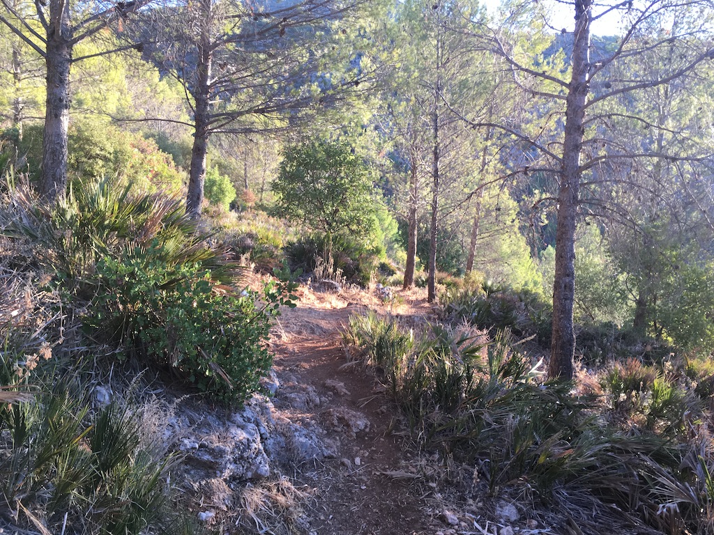
Imagen del camino
Algodonales is on the southern edge of the Sierra de Lijar, on the Vega del Guadalete. It’s situated in the Sierra de Cádiz between small mountains where olives are cultivated, and there is well conserved mediterranean forst.

For this route we will meet at 10.30 a.m. in the center of Algodonales at the Plaza de la Constitución in the Asturian bar next to the church of Santa Ana, whose coordinates are 36.880920,-5.405866. The picture of the Plaza is below.
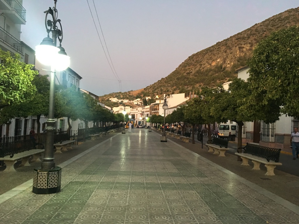
Plaza de la Constitución
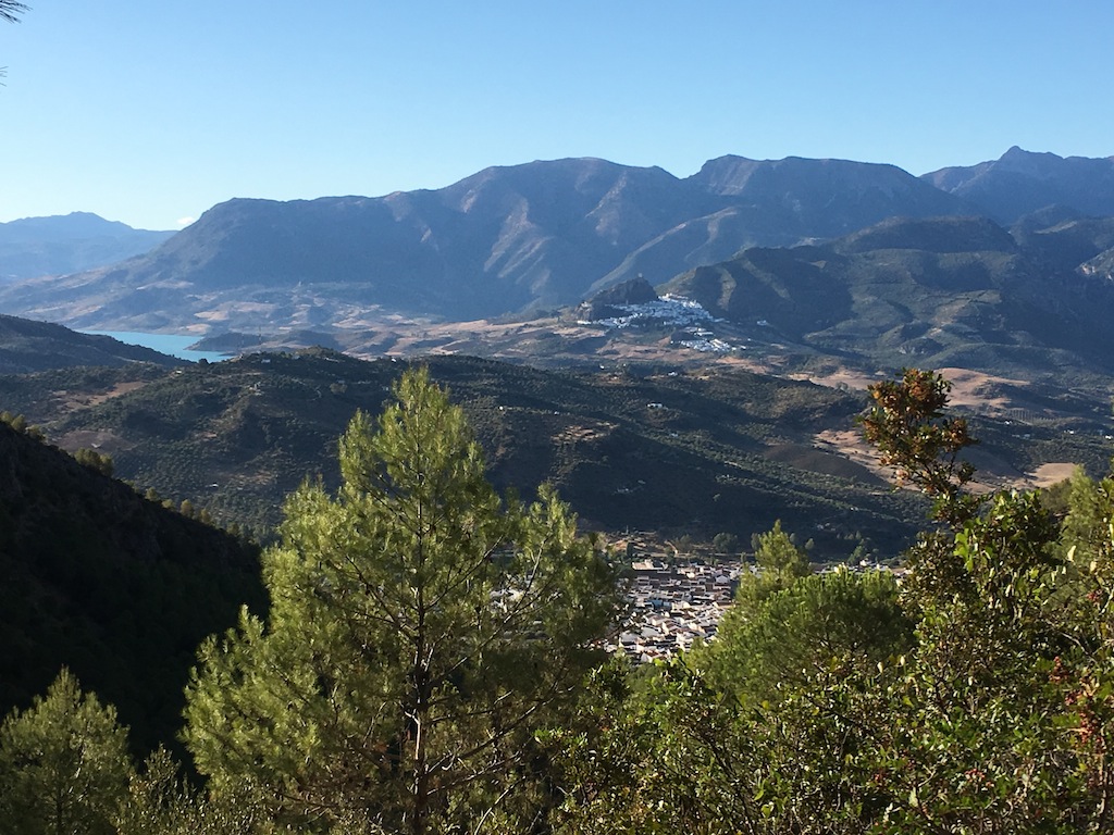
It is important to have breakfast half an hour before we start, and to warm up properly, as from the first minute of the route we start climbing upwards. In the first ascent we start climbing the street of the fla Calle de La Feria, cross the Virgencita, and reach a Mediterranean pine forest. The photos of the Algonales area below are beautiful, and you’ll be able to take plenty of fantastic photos en route.
Bosque mediterráneo
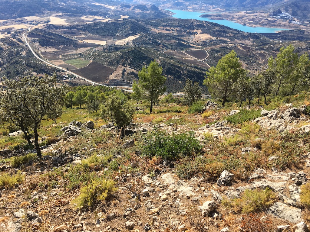
After 4.4 km of climbing, we reach the viewpoint where we will stop to for a breather and a snack. It is worth stopping briefly on the way up to take note of the swamp of the Gastor, Zahara de la Sierra and Fondo Grazalema.
Vista desde arriba
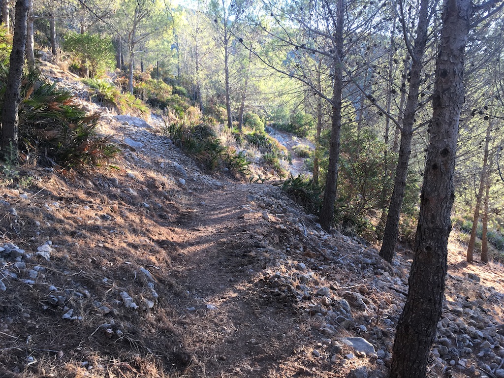
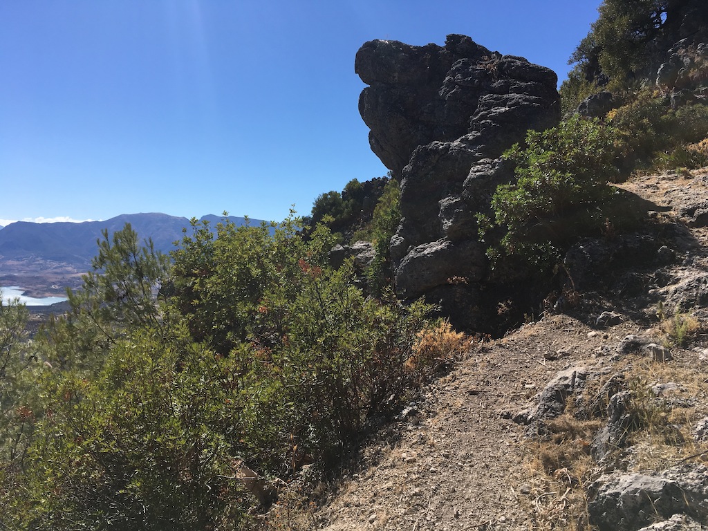
Once at the top, we walk along a dirt track and then between rocks, always with the Pantano del Gastor (a swamp) beneath us. The end of this stretch is the highlight of the route.
Subida del Cortafuegos
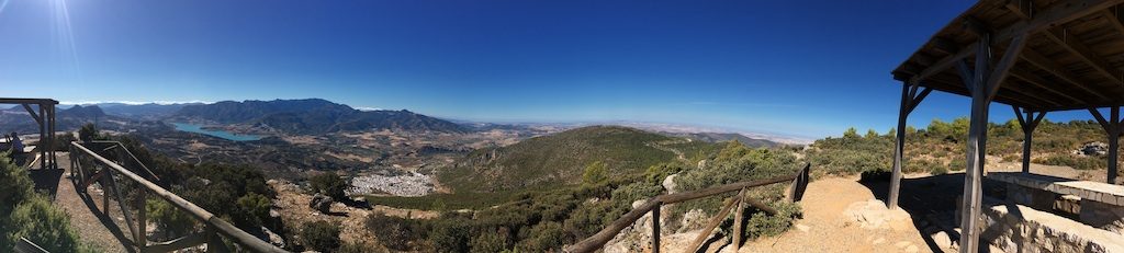
Once up we reach the Mirador de Levante we’ll stop for a quick snack. We will have fabulous views of the Sierra de Montecorto, the Gastor, the Algarín, the Sierra de Libar, the Monte Prieto, the Gastor Reservoir, Zahara de la Sierra, the Sierra del Pinar, Sierra Margarita, Algodonales and Prado del Rey. A view that definitely makes the climb worth it.
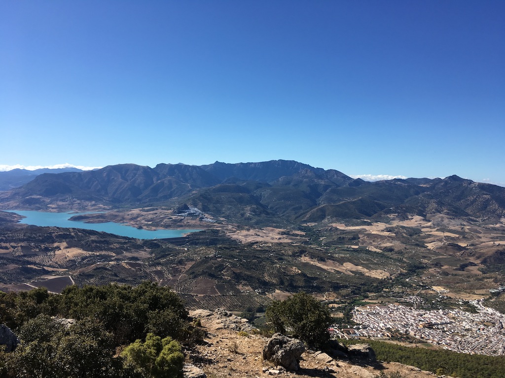
Vista desde el Mirador de Levante
This is the midpoint of the trip, and from now on the route will be between rocks and roads, taking us to the viewpoint of Poniente, where we stop to eat and from there the descent to Algodonales.
Cresteando en Algodonales
The price of this trip is 5€ and only for club members. We’ll meet at the Cervecería Ronda el Alamillo de Sevilla for those that can share cars and leave at 8 a.m.

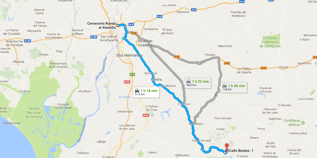
Recorrido desde Sevilla

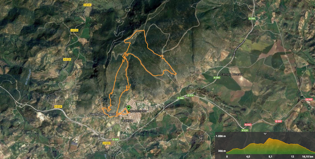
Track de la ruta